Cartography of the Tolima Volcano, a project carried out with the Tolima Participatory Monitoring Network.


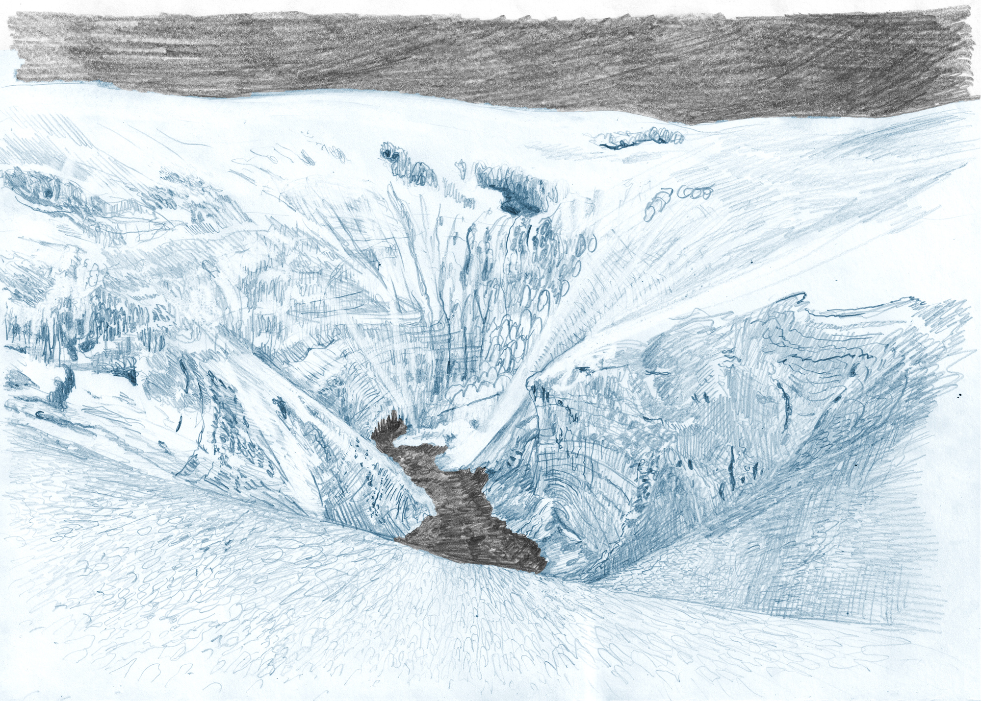
This cartography is inspired by the ideal perspectives of the Chorographic Commission of the mid-19th century in Colombia, through which a landscape was graphically and consensually interpreted in order to travel, understand and apprehend it. The cartography depicts the north and south sides of the Nevado del Tolima Volcano, including the Kraus, Totare, Pijao and Shimmer glaciers in the first, and the Combeima, Dulima, Ambalá glaciers and the crater in the second. It also shows the retreat that the glacier area has had from 1959 to 2022.
Designed and published by Nómada Ediciones
98 x 68 cm (open)
23 x 16.5 cm (closed)
ISBN 978-628-01-6278-2
2024
CRÉDITOS
Un proyecto de Natalia Castañeda Arbeláez en apoyo con la Red de Monitoreo Participativa del Volcán Nevado del Tolima.
Investigación colectiva generada en Cuerpos glaciares, ancestros hídricos de una extinción futura.
Dibujo, cartografía y conceptualización: Natalia Castañeda Arbeláez
Edición: Nómada Ediciones y Territorios Comunes
Diseño: Mónica Naranjo / Nómada ediciones
Asesoría científica y en montaña: Saida Martinez, Andrés Cruz, Juan Camilo Otalvaro, Jorge Luis Ceballos, Katherin Diaz, Cristian Alarcon y Sebastian Barbosa
Fuentes de información: Análisis morfométrico del retroceso glaciar en el Volcán Nevado del Tolima de Andrés Cruz, IDEAM y Servicio Geológico Colombiano.


